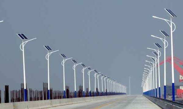
With the rapid development of computer software and hardware technology, computers have penetrated into all areas and levels of social life. For the storage, processing and analysis of information, computers have unique advantages. In particular, the development and maturity of geographic information system technology in the past ten years has provided sufficient means for using computers to manage streetlight information. This article mainly introduces the use of computer technology to realize the informatization of street lamp management and what kind of GIS products should be selected, and what functional requirements should be provided for informatization management.
Technical Basis of Street Light Management Information
When constructing the street lamp information management system, an important issue to be considered is the technical solution. From a global practice point of view, there are mainly five technical solutions adopted for the use of computers to achieve street lamp management.
1. DBMS
The management information uses a database management system (DBMS) to sort and enter the coordinate data and card information of the existing street lights, and place them in one or more data tables in the database system. Develop conventional attribute data management functions on the DBMS, such as entry, modification, deletion, and query.
This method can effectively manage the existing street lamp attribute data and the card information of various equipment, which is convenient for query and classification. However, such a system does not manage graphics at all, and cannot solve the maintenance problems of various graphics, let alone retrieval and analysis based on spatial data.
2.MIS
Use MIS to store and process attribute data. Design drawings, as-built drawings, street lamp general drawings, large-scale drawings and other drawings are entered through another graphics system (AutoCAD, CorelDraw, etc.) and stored separately in the form of files.
In this scheme, the attribute data and the graphic data are separated and not related to each other. Although it provides a means for drawing maintenance, the graphic data only stays at the level of copying the drawing, and the rich information contained in the drawing itself It cannot be automatically recognized, extracted and utilized by the system. Essentially, this scheme just extends the MIS thinking to graphic data.
3. Desktop graphics information system
Using the method of connecting database and graphics, or using desktop graphics information system, it is a real surpassing of traditional MIS thinking. The basic idea is to extend the field in the attribute data table to store the primitive number or data index of the corresponding graphic, and associate the graphic with the corresponding attribute record, so as to realize the mutual check of the figure number.
In the concrete realization of the system, the secondary development can be done on the DBMS and the graphics system at the same time, and it can be constructed by oneself. You can also use ready-made desktop graphics information systems (such as MapInfo, AutoCAD Map, etc.) as a platform for development.
Due to the realization of the association of graphics and attributes, a single graphic element has “meaning”, which lays the foundation for the retrieval and analysis of spatial data.
However, such a system has the following shortcomings:
1) The loose coupling of graphics and attributes makes the maintenance of the relationship more complicated.
2) The relationship between graphic elements (such as the relationship between administrative regions, the penetration of pipelines and pipelines, the connection relationship between street lights and other facilities and cables, etc.) cannot be effectively managed, and in-depth analysis is difficult to complete. Even if it can be achieved, the efficiency is extremely low.
3) Lack of means for integrated management of massive data.
4. Real-time monitoring system
The real-time monitoring system can be used to remotely monitor the operating status of street light distribution facilities. It plays a very important role in turning on and off the street lights. The real-time monitoring system realizes centralized control, improves labor productivity, and reduces operating costs. However, the real-time monitoring system only manages power distribution facilities and operating status, but cannot manage a large amount of street lamp information.
5. Geographic Information System (GIS)
Use geographic information system to uniformly manage graphics, attributes and topological information.
The street light information and the terrain and environmental information related to the street light are basically geographic information. In addition to the general characteristics of information, such as sharing and objectivity, geographic information also has special characteristics such as regional distribution (characteristics of spatial positioning), huge amount of data, and diverse information carriers. This determines that traditional database management concepts and methods cannot effectively manage and analyze complex geographic information.
Therefore, Geographic Information System (GIS), as an emerging discipline integrating computer science, geography, surveying and remote sensing, environmental science, urban science, space science, management science and related disciplines, has emerged rapidly in the past 30 years.
Geographic information system is a computer information system used to collect, simulate, process, retrieve, analyze and express geospatial data. GIS technology unified management of spatial location, attribute characteristics and domain characteristics related to geographic information, and organized and used geographic information in a new way to analyze and obtain new geographic information more effectively. At the same time, the application of geographic information system has also changed the way of geographic information distribution and exchange.
The advantages of GIS technology
As a new general technology, GIS is not only unique in the content of the data it manages. There are also many characteristics in theory and methods, and correspondingly many new and important functions cannot be provided by traditional methods. For example, geographic information systems pay special attention to the effective management of massive spatial data, the management of topological structures and the automatic generation of topological relations, and the special emphasis on space-related query statistics and spatial analysis (polygon overlay, buffer analysis, network analysis) Etc.), provide a variety of spatial data input and output methods, and so on. And these functions are exactly what a complete street light information system should have.
The Role of Geographic Information System in Urban Lighting Information Management
Increase the level of information sharing. For example, although the communication network data is input and managed by related departments, when other departments are constructing, the distribution of cables can be quickly obtained through shared query. In the same way, it is also easier to understand the distribution of other public facilities, so as to avoid accidents such as digging broken optical cables and piercing gas pipelines.
Improve the data update cycle. When a certain part of the street light facility is changed, as long as the changed part of the street light diagram is input, the data in the computer network will be updated, so that the user can quickly understand the current status of the street light facility.
The query is very convenient. Using simple spatial query and spatial overlay operations, different users can overlay basic city data directly on the computer screen. Such as administrative area boundaries, topographical maps, etc., together with various related materials, can know the current distribution and development of urban street lighting facilities.
Improve the level of street lamp management. Using network analysis, you can easily simulate the fault range and find the power point. Using buffer analysis, reasonable inspection areas and routes can be formulated. This can greatly improve the level of automated management of the street light system, promote business standardization and procedural development, reduce costs, improve production efficiency, and serve the society.
Through the analysis of the above several information system technical solutions, we can see that in order to truly realize the integrated management of street lamp spatial data, attribute data, and topological relationships, and to make full use of existing street lamp and topographic data, GIS technology is a must.
What Kind of GIS Product Meets the Needs
At present, there are many types of GIS products in the international market. What GIS product should be used as the system platform when implementing street lamp information systems?
1. Use European ones, American ones or Chinese ones?
GIS was originally developed in the Americas and Europe. GIS products entered China earlier, the market operation is greater, and the interface and functions also have their own unique features, which have a greater impact. However, there are obvious problems in using foreign products.
The first is the question of language and usage habits. Many softwares in Europe and the United States have not been localized or fully localized. The second is the large investment required. A system with more complete functions has high software prices and high upgrade costs. There are certain requirements for data security and confidentiality, and there are hidden dangers when using this type of software.
In addition, European and American software is not comprehensive. The compilation and publication of complex maps are not perfect, especially in meeting the special needs of users. Due to the geographical separation and difficulties in understanding and communication, it is difficult for foreign companies to meet this demand in a timely manner.
2, choose one based on workstation or above, or choose one based on microcomputer?
A complete GIS system is not just a piece of software, but also includes many factors such as hardware environment, operating system, data, and personnel. Therefore, the overall consideration should be given to the system selection.
Existing GIS products have different requirements for hardware, including computer-based, workstation, minicomputer and even higher-end systems. There is no substantial difference in function of GIS systems based on different hardware, and the processing speed and capabilities of computers are also rapidly improving.
At present, most companies use computers for daily office work, using Windows series of operating systems. In this configuration, a variety of software such as office systems, charging systems, etc. have been running. The GIS system uses computers on the client side, which is conducive to making full use of existing hardware and saving investment. The operator is easy to accept and easy to master. It is also conducive to the integration and data sharing of the street lamp system with other existing systems.
3. Choose the stand-alone version or the online version?
GIS products have evolved from a stand-alone computer to a client/server or browser/server model based on a computer network environment. This is the result of the development of computer science and technology.
In a stand-alone GIS system, data can only be stored on a single machine and operated by one person. However, the data related to street lights is extremely large, and it is difficult to rely on a single person to enter and maintain it. It also contradicts the division of labor and business processes of street light management, which is not conducive to dynamic data update and sharing.
The network version of the GIS system allows multiple people to manipulate the same data in parallel. Use the authority control mechanism and mutual exclusion function provided by the operating system and the database to maintain the security and unity of the data, allowing multiple departments to dynamically maintain the street light data in accordance with the business process to ensure the reality of the data.
More importantly, the street light data on the server can be inquired and retrieved at any time by all departments or customers that need it, which is convenient for handling accidents in a timely manner, organizing construction, strengthening social service functions, and maximizing the role of street light data. Therefore, street lighting departments, especially street lighting management departments in large and medium-sized cities, should use the network version of the GIS system.
4. Choose a full-featured GIS or a desktop graphics information system?
Now there are some software called geographic information systems on the market, which are actually desktop graphics information systems. The interface of this kind of software is more beautiful, the graphics drawing function is unique and easy to use, and the attribute management and query of graphics can be realized by linking with database records.
As mentioned earlier, the disadvantages of this system are that it cannot manage graph topology, has low spatial analysis capabilities, is difficult to process large amounts of data, does not have a library management module, and cannot handle 3D models. These deficiencies make the pipeline information system using this software as a platform unable to operate effectively, and the data cannot be fully utilized. On the contrary, a full-featured GIS software should automatically maintain spatial topology, effectively manage massive amounts of data, and have modules such as library management, digital terrain models, and spatial analysis and retrieval. The informatization of the street lamp information management system should adopt the full-featured GIS software based on the above-mentioned functions.
Based on the above analysis, the GIS platform of the street lamp information management system information should adopt a system with a beautiful interface and in line with people’s habits. You should use a full-featured GIS product on the Internet that uses a computer as the client’s operating environment.